 English
 ไทย
ไทย Publications
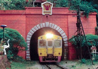
Tunnelling and Deep Excavation Works in Thailand - Past, Present and Future
Located in Southeast Asia, between latitudes 5’ 37’ N and 20”27” N and longitudes 97” 22” E and 105” 37” E, Thailand covers an area of 518,000 km2. The country can be divided into four main physiographic regions; the mountainous highland in the north and northwest, the Khorat plateau in the northeast, the central plain and the southern peninsular.
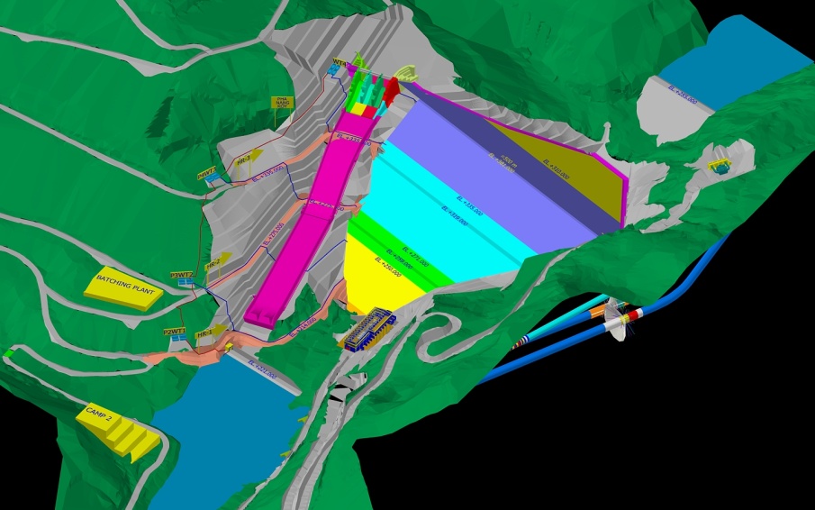
Construction Aspects of Power Waterway Tunnel in NN2 Hydro Electric Project, Laos
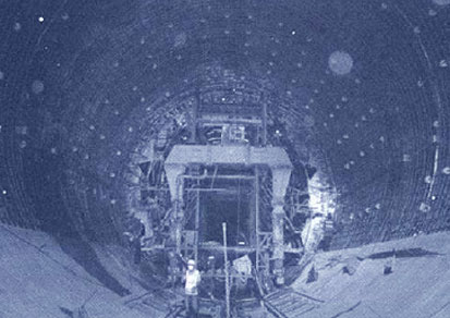
This paper reviews the Construction aspects of 10.7 m diameter, Power Water Way Nam Ngum 2 Project, Laos through which water is being conveyed from reservoir to turbines. It is a low pressure tunnel consisting of four components: – 10.7 m diameter Main Head Race Tunnel part consisting of a 405m concrete lined section followed by a 60m steel lines section,
Construction of Ratchaphruek-Nakhon In Underpass

The Ratchaphruek Circle is currently among the most congested areas in Bangkok, especially during the rush hours, resulting in a heavy traffic and frequent accidents. The Department of Rural Roads thus takes into account various solutions to the issue.
Dam Safety Risk Assessment for Kiu Kor Mah and Kiu Lom Dams
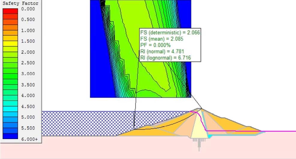
Dams are usually categorized as high-hazard, low risk structures. That is, even though, the probability of dam failure is extremely low, but dam failure can cause catastrophic consequences downstream, including loss of life and property damage, economic loss as well as social and environmental impacts. Dam failure can be caused by overtopping a dam due to insufficient spillway capacity, internal erosion or piping through the embankment dam, instability of slope embankment, earthquake, equipment malfunction, foundation and abutment failure, landslide or by sabotage.
Design, Construction and Performance of Nam Ngum 2 CFRD
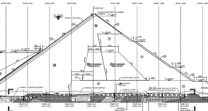
The Nam Ngum River is one of the major tributaries of the Mekong River which forms the border between Laos and Thailand in this area. The Nam Ngum River originates on the Tran Ninh Plateau, north of Xeong Khuang, and after flowing past both dam sites, joins the Nam Lik River and flows into the Mekong River about 100km downstream of Vientiane. The Nam Ngum 2 Hydroelectric Power Project (NN2 HPP) is located approximately 90km north of Vientiane in central Laos and approximately 35km upstream of existing Nam Ngum 1 reservoir.
Design of Reinforced Concrete Linings of NN2 Headrace Tunnel
The Nam Ngum 2 Hydroelectric Power Project (NN2 HPP) is located approximately 90 km north of Vientiane in central Laos and approximately 35 km upstream of Nam Ngum 1 reservoir. A reservoir is impounded by a 182 m high Concrete Face Rockfill Dam (CFRD). The head of NN2 HPP is 165 m, and its installed capacity is 615 MW, with three Francis units. The connection between NN2 reservoir and the powerhouse consists of a intake structure, a 460 m long headrace tunnel,